|
|
| Home | Join us | Notices and Contacts | History of the area | Newsletters |
|---|---|---|---|---|
| What we do | Area Covered | History of the Association | Conservation Area | Links |
|
|
The house and estate changed hands several times until it was purchased by Henry Daniel Davies in 1850. Davies was a property developer and laid out plans for an impressive estate of roads and large houses surrounding Spring Grove House. He built St. Mary’s Church and a number of large houses on Osterley Road, Thornbury Road, The Grove and Eversley Crescent. Information from the “History of Spring Grove” by Gillian Morris.
Spring Grove was one of the most ambitious middle-class projects, and is said to have been chiefly designed for retired army officers. It was laid out in the early 1850’s, a church was built in 1856, and in the same year the rapid rise of the district was noted as a remarkable result of the new railway system. The good beginning was soon over: by 1865 only a few villas, including Thornbury House (now Campion House), where H. D. Davies, the promoter of the estate, lived, stood in their gardens along the roads round the church, though there was a rather larger number in the Grove. Very few houses of the original type were added to the estate later and though a number of retired soldiers seem to have lived there at first, the failure of the project was implicitly acknowledged in 1888. Close by, the International College (opened in 1867) represented another plan which never fulfilled the original hopes: the building, which was in the Gothic style, was taken over in 1890 by the Borough Road Training College. To the south of Spring Grove (now Isleworth) Station, Woodlands was a slightly humbler version of Spring Grove: the houses had gardens but many were semi-detached. It was first developed at about the same time but managed to sustain its progress more steadily later. It received its church just after Spring Grove. Taken from SGRA Newsletter of November 2009, sourced from: “Heston and Isleworth: Introduction”, A History of the County of Middlesex: Volume 3: Shepperton, Staines, Stanwell, Sunbury, Teddington, Heston and Isleworth, Twickenham, Cowley, Cranford, West Drayton, Greenford, Hanwell, Harefield and Harlington (1962), pp. 85-94. URL: http://www.british-history.ac.uk/report.aspx?compid=22270&strquery=london%20apprentice%20isleworth
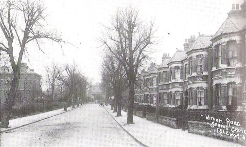 Picture of Witham Road 1913 from the book “Isleworth” by Mary and Kevin Brown.
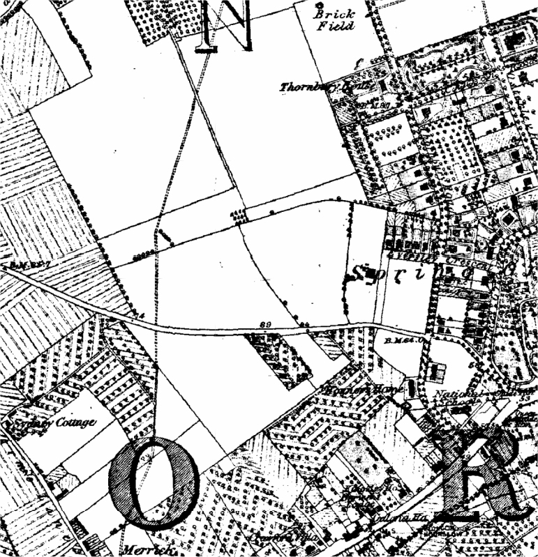
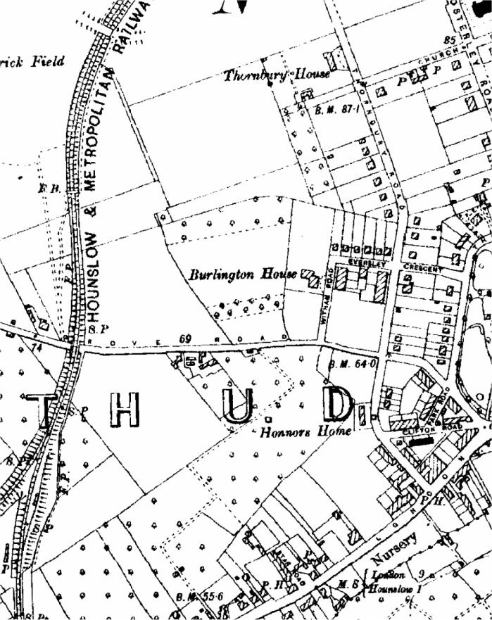
Extract scan of Ordnance Survey map of 1894 (click on the map for a full-size version): 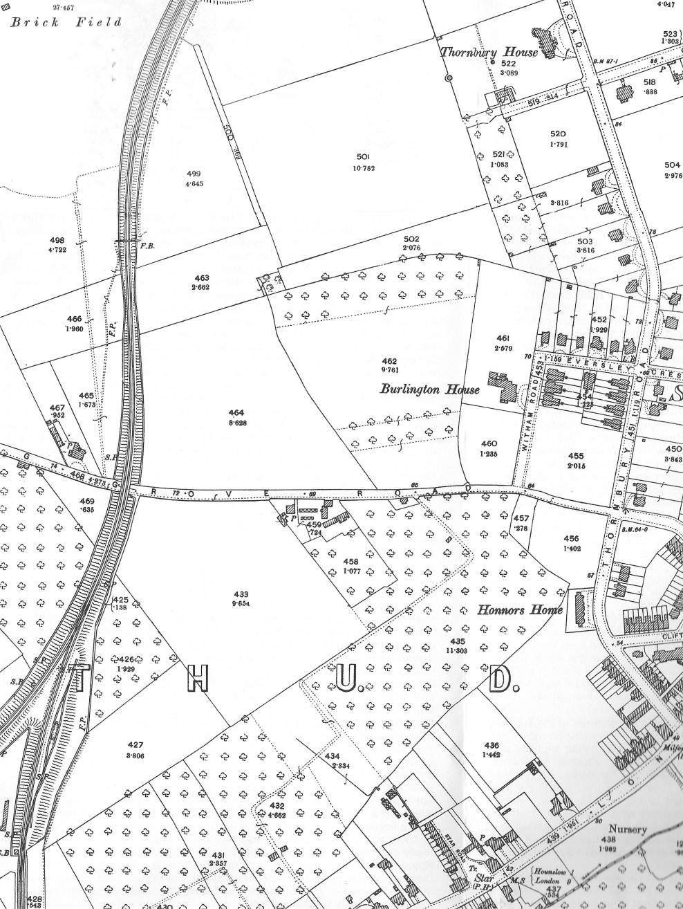
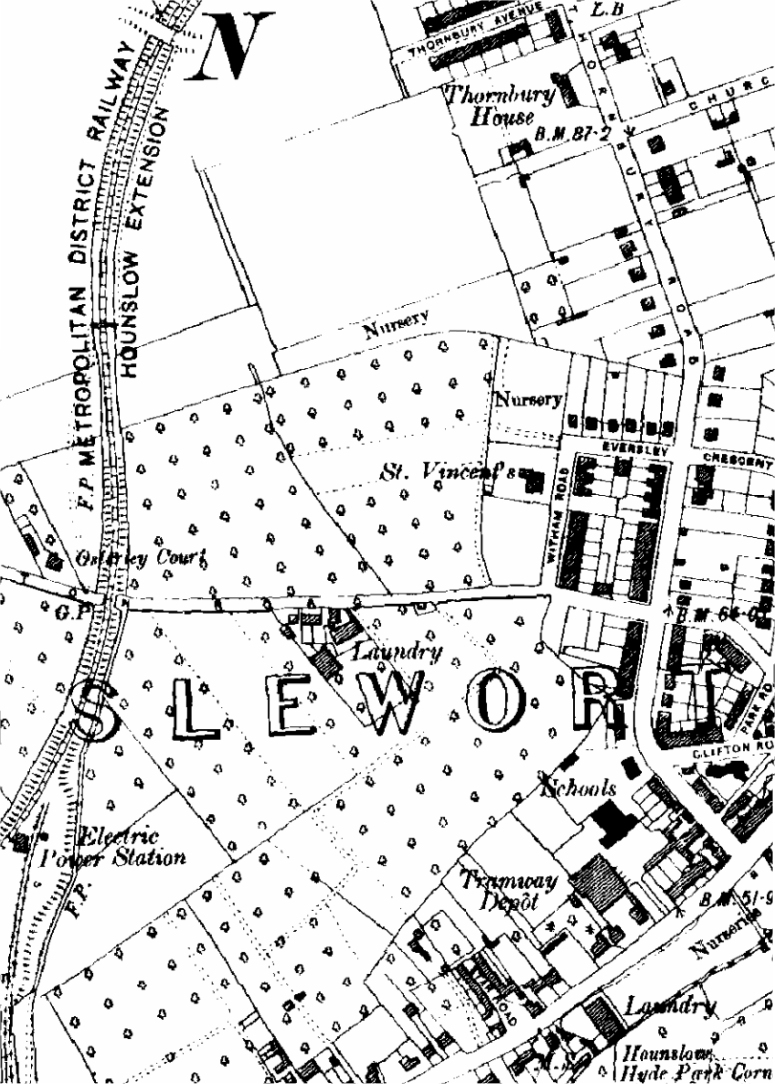
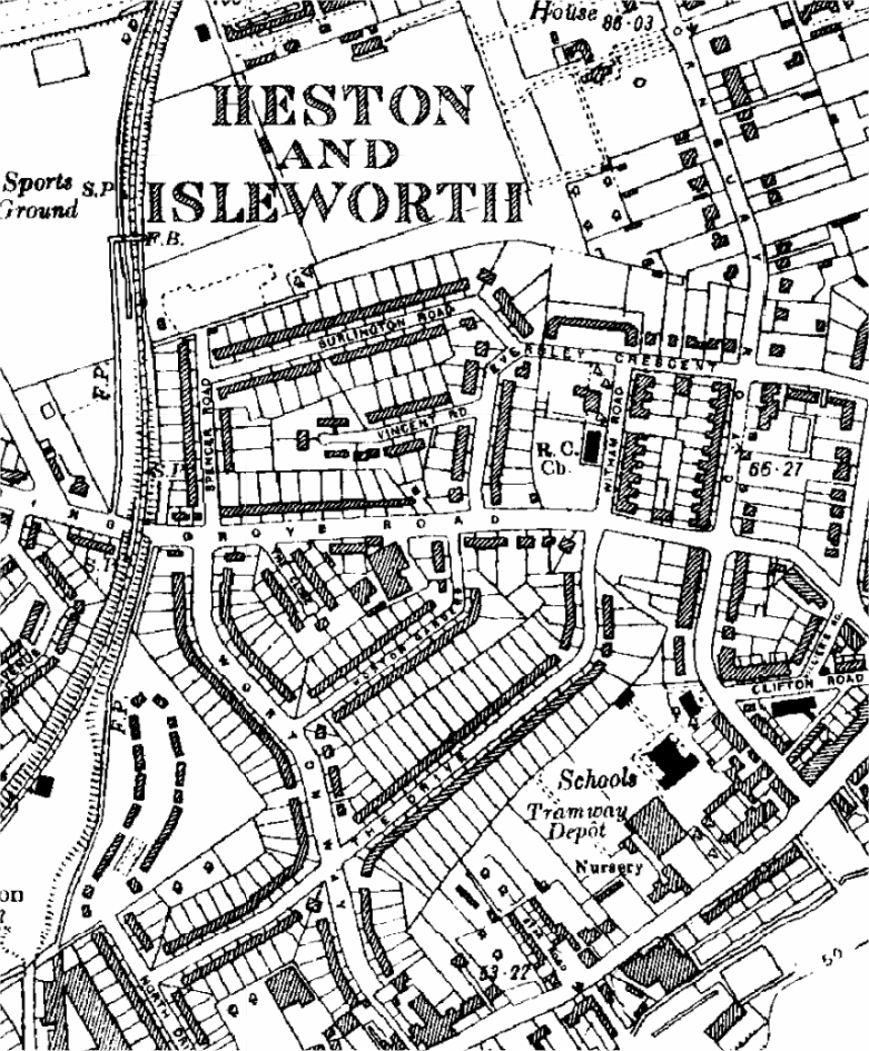
However, in 1935, the picture is very different (click on the map for a full-size version): 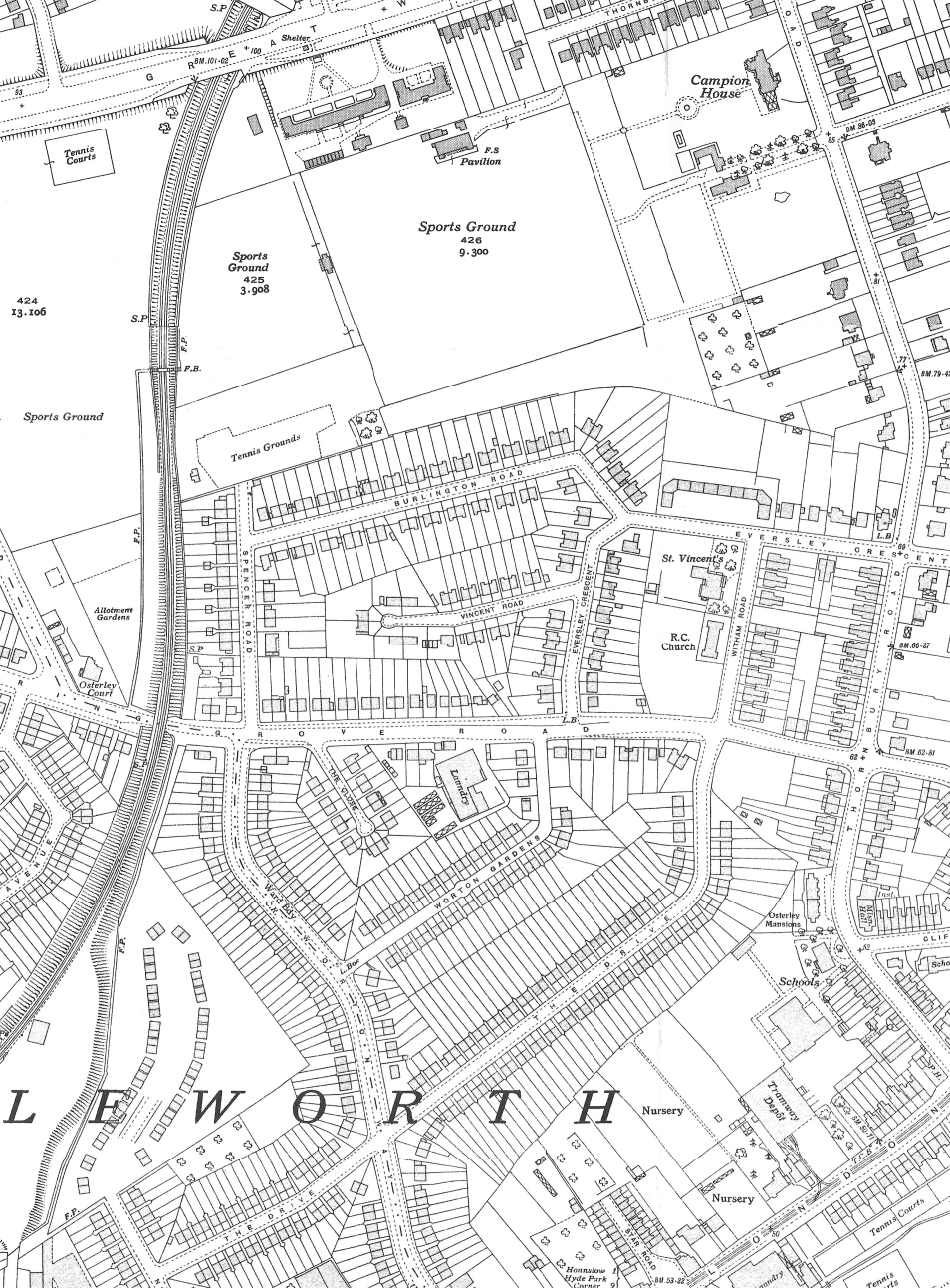
It‘s even possible to overlay these two maps on top of each other which helps to show where the old field boundaries fall, a number of them follow the lines of back gardens (click on the map for a full-size version): 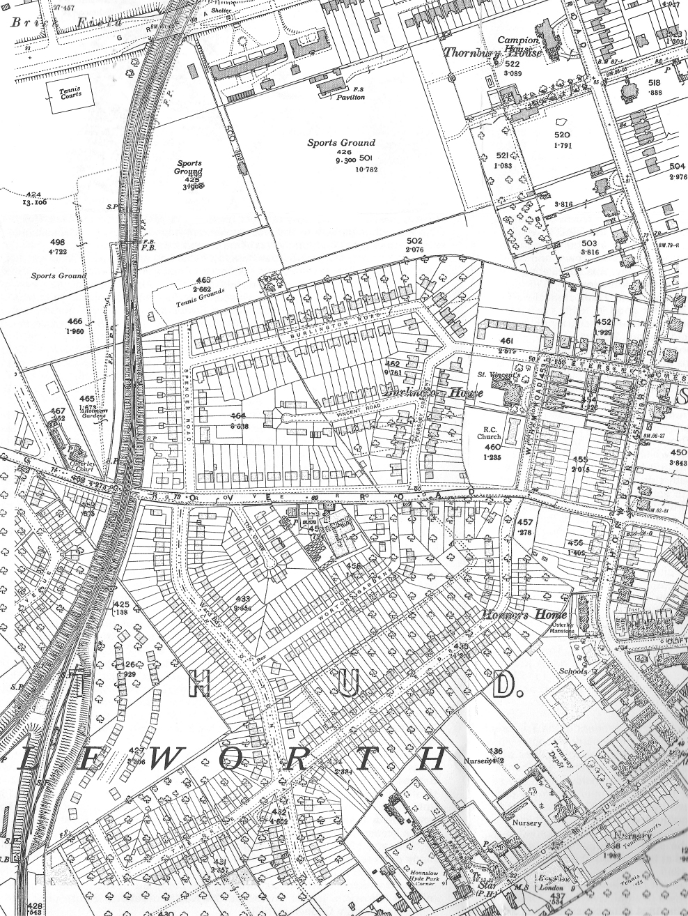
Extracts of old maps of the area from http://www.old-maps.co.uk/ (click on any map for a full-size version in a new window):
See also: |